The Adana Metro —officially known in Turkish as Adana Metrosu or Adana Hafif Raylı Sistem— is the fully segregated light metro system of the fifth-largest city in Turkey. The network has 1 line (Hastane–Akıncılar), 13 stations and 13.5 km of route, combining underground, elevated and surface sections. Opened on 18 March 2009, it runs from 06:00 to 23:30 with 10–15 minute headways. Payment is by Kentkart contactless card (flat fare). The metro does not connect to any airport — the old Şakirpaşa airport closed in August 2024 and the new Çukurova airport has no metro link. A second phase toward Çukurova University is in the approval process.
| Adana Metro — key facts (2026) | |
|---|---|
| Official name | Adana Metrosu / Adana Hafif Raylı Sistem |
| Active line | M1: Hastane – Akıncılar |
| Stations | 13 |
| Network length | 13.5 km |
| System type | Segregated light metro (hafif raylı sistem) |
| Opening | 18 March 2009 (Hastane–Vilayet) · 14 May 2009 (complete) |
| Operator | Adana Büyükşehir Belediyesi (Metropolitan Municipality) |
| Rolling stock | 36 Hyundai Rotem LRV (3-car trains, 933 seats/train) |
| Hours | Daily: 06:00–23:30 (check official site for changes) |
| Frequency | 10 min (peak) · 15 min (off-peak) |
| Fare | Flat fare, paid with Kentkart |
| Airport connection | None (Çukurova Airport not connected; Şakirpaşa closed Aug 2024) |
| Official website | ulasimbilgi.adana.bel.tr |
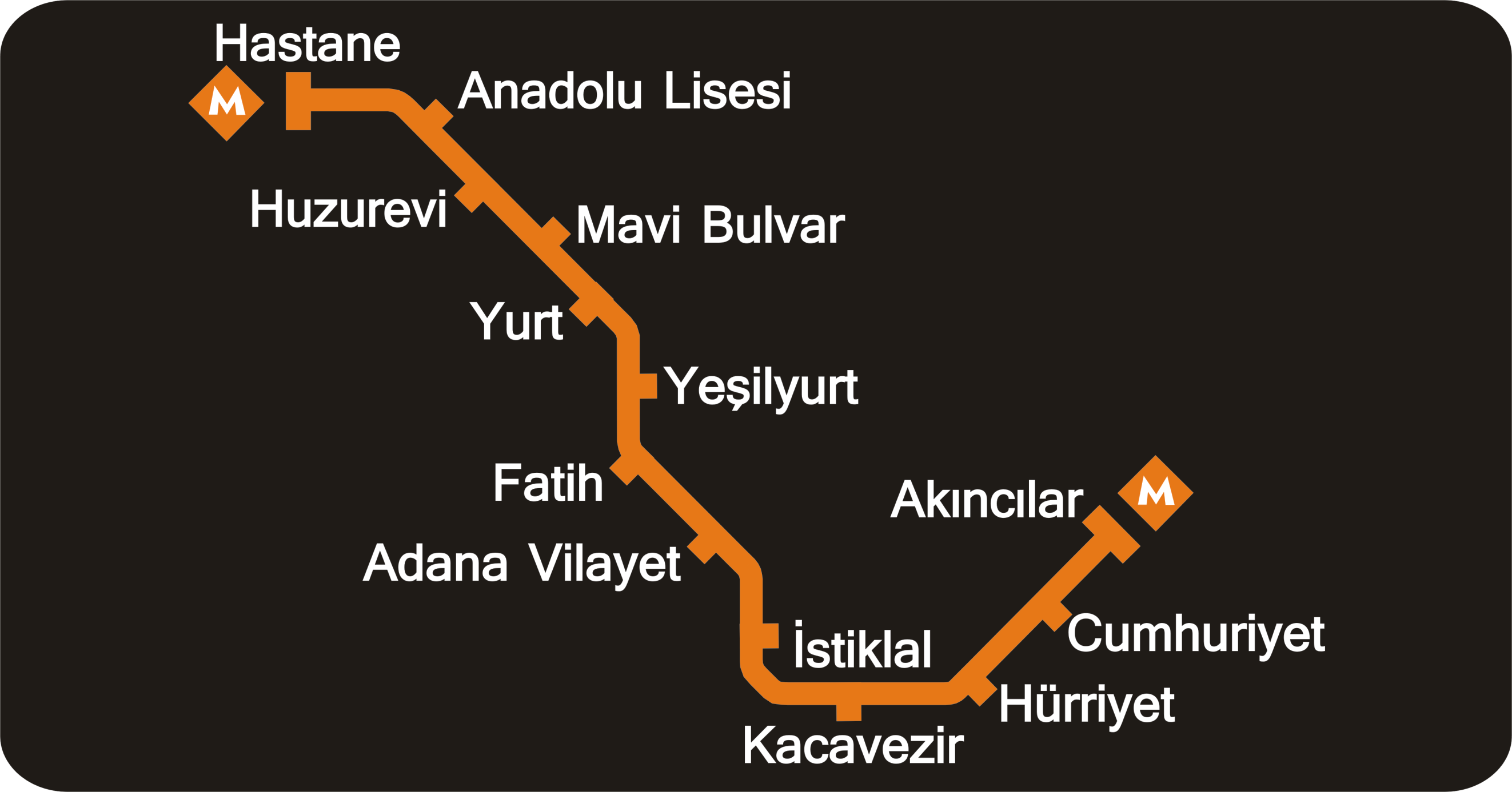
Line M1: Hastane – Akıncılar
The Adana Metro operates a single line (M1) running northwest to southeast across 13.5 km. It starts at the hospital area in the northwest (Hastane), runs along Turgut Özal Boulevard, passes through the administrative centre (with underground sections), crosses the Seyhan River on a steel railway bridge, and terminates at the Yüreğir bus terminal (Akıncılar). The full journey takes approximately 21 minutes.
The line is fully segregated — no level crossings with road traffic — and combines three types of infrastructure: underground cut-and-cover tunnels, surface sections, and elevated viaducts. This variety makes Adana Metrosu one of the most visually distinctive urban rail systems in Turkey.
| # | Station | Level | Notes |
|---|---|---|---|
| 1 | Hastane | Underground | Northwestern terminal. "Hospital". Healthcare zone. |
| 2 | Anadolu Lisesi | Underground | "Anatolian High School". Turgut Özal Boulevard. |
| 3 | Huzurevi | Surface | "Rest home". Northern residential area. |
| 4 | Mavi Bulvar | Surface | "Blue Boulevard". Residential urban axis. |
| 5 | Yurt | Surface | Residential area. |
| 6 | Yeşilyurt | Surface | "Green land". Residential neighbourhood. |
| 7 | Fatih | Elevated | Historical name (Mehmet II). Mid-line stop. |
| 8 | Vilayet | Underground | Provincial administration hub. Connection to Adana railway station. End of first phase (18 Mar 2009). |
| 9 | İstiklal | Underground | "Independence". City centre. Near D-400 road. |
| 10 | Kocavezir | Elevated | Commercial and traditional urban area. Most useful for tourists. |
| 11 | Hürriyet | Elevated | "Freedom". Section over the Seyhan River. |
| 12 | Cumhuriyet | Elevated | "Republic". Eastern section. |
| 13 | Akıncılar | Elevated | Southeastern terminal. Connection to Yüreğir bus terminal. |
Fares, tickets and Kentkart
The Adana Metro uses a flat fare system — the price is the same regardless of the distance travelled. The main payment method is the Kentkart, a rechargeable contactless card also valid on city buses. Cards can be purchased and topped up at vending machines in stations and authorised points across the city.
| Passenger type | Fare/trip | Notes |
|---|---|---|
| Standard (Kentkart) | Flat fare | Current price: check official website. Kentkart required for discounts. |
| Students | Reduced | Personalised student card required (Abonman Öğrenci Kartı). |
| Teachers | Reduced | Personalised professional card. |
| Over-65s | Reduced / free | ID document required for card application. |
| Disability | Reduced / free | Medical documentation required. |
| Children under 6 | Free | No card required. |
Current prices are published in UKOME documents by the Adana Metropolitan Municipality. Always check the official website for up-to-date fares, as the Turkish lira has undergone significant fluctuations in recent years.
Adana Metro hours
| Day | First train | Last train | Frequency |
|---|---|---|---|
| Weekdays (peak) | 06:00 | 23:30 | ~10 minutes |
| Weekdays (off-peak) | — | 23:30 | ~15 minutes |
| Weekends | 06:00 | 23:30 | ~15 minutes |
2026 maintenance note: In January 2026, the Municipality announced a temporary change for annual track maintenance: 06:00–21:00 every 15 min; 21:00–23:00 every 30 min. Check the current timetable at ulasimbilgi.adana.bel.tr/metro.
Connections and complementary transport
With a single line, the metro covers the city's main axis but does not reach all districts. It is complemented by municipal buses and dolmuş minibuses, both characteristic of Turkish cities.
Municipal buses
The city bus fleet covers the whole city and uses the same Kentkart as the metro. Key bus connections at metro stations:
- Hastane: routes to Bahçeşehir, Carrefour and Adana Koop.
- Anadolu Lisesi: Seyhan Hospital, Kurttepe, Demirel Boulevard.
- Yurt: Barış Manço Blvd, HayalPark, Mavi Blvd.
- Fatih: Kıyıboyu, Cemalpaşa, Hastaneler.
- Vilayet: Railway station (Gar), Atatürk Road, Atatürk Park, Valilik.
- Kocavezir: Kuruköprü, Küçüksaat, Saydam Road, Obalar Road.
- Akıncılar: Yüreğir bus terminal; routes 110, 113, 114, 116, 118, 126 toward Kozan Yolu.
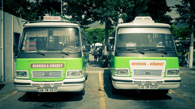
Dolmuş
 Dolmuş (shared minibus): Image via Kenneth Wong
The dolmuş are shared minibuses with fixed routes and flat fares, operating throughout the city. 18 cooperatives run this service in Adana. Cash only. To request a stop, say «İnecek var!». They are the main transport option in many peripheral neighbourhoods not served by metro or bus.
Airport connection
The Adana Metro has no direct airport connection. The local airport situation changed significantly in 2024:
- Adana Şakirpaşa Airport (ADA) ceased regular commercial operations in August 2024.
- Flights were transferred to the new Çukurova International Airport, located further north.
- The metro does not serve Çukurova Airport either.
To reach Çukurova Airport from Adana, options include taxi, shuttle bus or private transfer. Check current services with your accommodation or the airport website.
Sightseeing along the metro
The most useful stations for tourists are mainly Vilayet and Kocavezir:
- Sabancı Merkez Camii — Turkey's largest mosque, with six minarets and capacity for 28,500 worshippers. Located in Merkez Park beside the Seyhan River. Reach via Vilayet.
- Atatürk Park / Merkez Park — Large central green space. A few minutes' walk from Vilayet.
- Taşköprü (Roman Stone Bridge) — 4th-century Roman bridge over the Seyhan River. City symbol. Accessible from Vilayet or Kocavezir.
- Adana Railway Station (Gar) — Major rail hub with connections to Istanbul, Ankara and Iskenderun. Direct connection from Vilayet.
- Shopping and traditional market area — Between Kocavezir and İstiklal.
- Adana kebabı — The famous local dish (Adana kebab and şalgam) is best sampled in restaurants near Kocavezir or Vilayet.
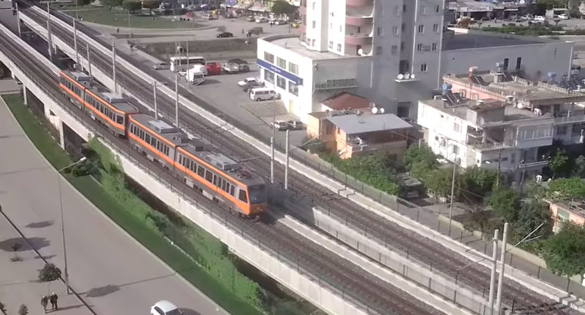 Adana Metro viaduct over the Seyhan River
History of the Adana Metro
The history of the Adana Metro spans more than two decades of planning, financing difficulties and construction. The process began in 1988, when the Municipality and Çukurova University requested a feasibility study from the Ministry of Transport. The project was redesigned between 1990 and 1993 to connect the northern and southern parts of the city through the centre.
Construction officially began on 28 January 1999, with Alarko as the main contractor under a turnkey contract covering 13.5 km of track, 13 stations, a viaduct, a steel railway bridge, cut-and-cover tunnels, electrical and signalling systems, and the supply of 36 vehicles. Works faced a severe financing crisis in 2002 when the central government refused the municipality's loan request, halting construction for six years.
New funding was secured in 2008 and works resumed. The first section (Hastane–Vilayet, ~8 km) opened on 18 March 2009 with free service for three months. The full line to Akıncılar (~5.5 km additional) opened on 14 May 2009. The system has been in continuous operation since, under municipal management.
Is it a metro or a light rail?
Although commonly called a "metro", the Adana system is more accurately described as a fully segregated light metro (hafif raylı sistem). Key distinctions:
- Fully segregated: no level crossings with road traffic anywhere on the line. This sets it apart from conventional trams.
- Not heavy metro: trains have lower capacity and the system has lower frequency than Istanbul or Madrid metros.
- UrbanRail classifies it as light metro, comparable to İzmir or Bursa in Turkey.
- The mix of elevated, underground and surface sections is characteristic of urban light metro systems.
Rolling stock: Hyundai Rotem LRV
The fleet consists of 36 Hyundai Rotem (formerly Hyundai Euroterm) light rail vehicles. Key data:
- Car capacity: 311 passengers per car
- Train capacity: ~933 passengers (3-car train)
- Fleet: 36 vehicles (12 × 3-car trains)
- Top speed: ~80 km/h
- Traction: electric (overhead catenary)
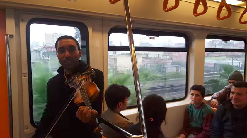 Inside an Adana Metro train
Second phase: the pending expansion
The second phase is Adana's most debated urban infrastructure project. Plans include a northeastern extension from Akıncılar with approximately 7 new stations and 9.3 km, reaching:
- Şehir Hastanesi (City Hospital)
- Çukurova University
- Balcalı (University Hospital)
- Stadyum (Stadium)
As of 2025–2026, the project is in the approval and financing stage — including external financing negotiations — with no confirmed start date for construction. The estimated cost exceeds €200 million. Once complete, the network would reach ~22.8 km and 20 stations.
Engineering: cut-and-cover tunnels
The underground sections use the cut-and-cover method: excavation from surface, construction of the tunnel box, and backfill. Academic studies from Çukurova University document: tunnel stabilisation, piling and anchoring, shotcrete application, and monitoring of horizontal ground movements during construction. The project also included a steel railway bridge over the Seyhan River, one of the system's most recognisable features.
Practical tips for using the Adana Metro
- Check the official timetable before travelling: ulasimbilgi.adana.bel.tr/metro. Each station has its own published timetable in both directions.
- Get a Kentkart at station vending machines — it is the cheapest way to travel and works on city buses too.
- Signage is in Turkish: English signs are limited. Learn the station names; the line is simple and linear.
- For Çukurova Airport: the metro does not go there. Use taxi, shuttle or bus.
- Peak hours: 07:00–09:00 and 17:00–19:00 on weekdays. Avoid with bulky luggage.
- Luggage limit: 15 kg and maximum dimensions 100×50×60 cm.
- Not permitted: full-size bicycles, skates, prams (bulky), pets (except guide dogs and small animals in carriers).
- Yellow line: always stand behind it until the train has fully stopped.
Facts and trivia
- From concept to opening: more than 20 years (1988–2009).
- Construction was halted for six years (2002–2008) due to funding problems.
- In just 13.5 km, the line combines underground, surface and elevated infrastructure.
- The steel bridge over the Seyhan River is one of the few railway structures over the river in the city's history.
- The Adana Metrosu logo is an orange diamond with a curved white "M".
- Despite being called a "metro", it is technically a fully segregated light metro.
Adana Metro map
 Source: Wikimedia Commons CC Share Alike
Frequently asked questions about the Adana Metro
When did the Adana Metro open?
The first section (Hastane–Vilayet) opened on 18 March 2009. The full line to Akıncılar was completed on 14 May 2009. Construction started in 1999 but was halted for six years (2002–2008) due to financing problems.
How many stations does the Adana Metro have?
It has 13 stations on a single line (M1), 13.5 km long, between Hastane and Akıncılar. The planned second phase would add 7 more stations to the northeast.
How much does the Adana Metro cost?
The fare is flat rate — the same price regardless of distance. Payment is with the Kentkart contactless card. Reduced fares exist for students, teachers, over-65s and disabled passengers. Children under 6 travel free. Check current prices at adana.bel.tr.
Does the metro connect to Adana airport?
No. The Adana Metro has no airport connection. The old Şakirpaşa Airport closed in August 2024 and flights moved to the new Çukurova International Airport, which also has no metro link. Use a taxi or shuttle.
Is it a real metro or a light rail?
Technically it is a fully segregated light metro (hafif raylı sistem). It is not a tram because it has no level crossings, and it is not heavy metro like Istanbul. UrbanRail classifies it as light metro.
How long does the full journey take?
The complete trip from Hastane to Akıncılar (or vice versa) takes approximately 21 minutes.
Update history
- May 2026 — Full revision: corrected opening date (2009, not 2010), updated fare and payment system (Kentkart), updated airport information (Çukurova replaces Şakirpaşa since Aug 2024), accurate second phase status (planning/approval, not under construction), station levels table, cut-and-cover engineering, rolling stock, and new guide in 11 languages.
- July 2017 — Original article content.
