First time in Saigon? The new metro saves you from traffic jams and surprises: Line 1 links the historic core (Bến Thành, Opera House) with modern neighborhoods and campuses to the northeast. Platform screen doors, brand-new Hitachi trains, and clear signage—getting around is finally simple.
This guide focuses on what actually matters: how to read the map, which ticket suits your plan (1–3 days or monthly), hours by phase, rules and accessibility, useful bus connections, and an all-in-one route to see the essentials in a single day.
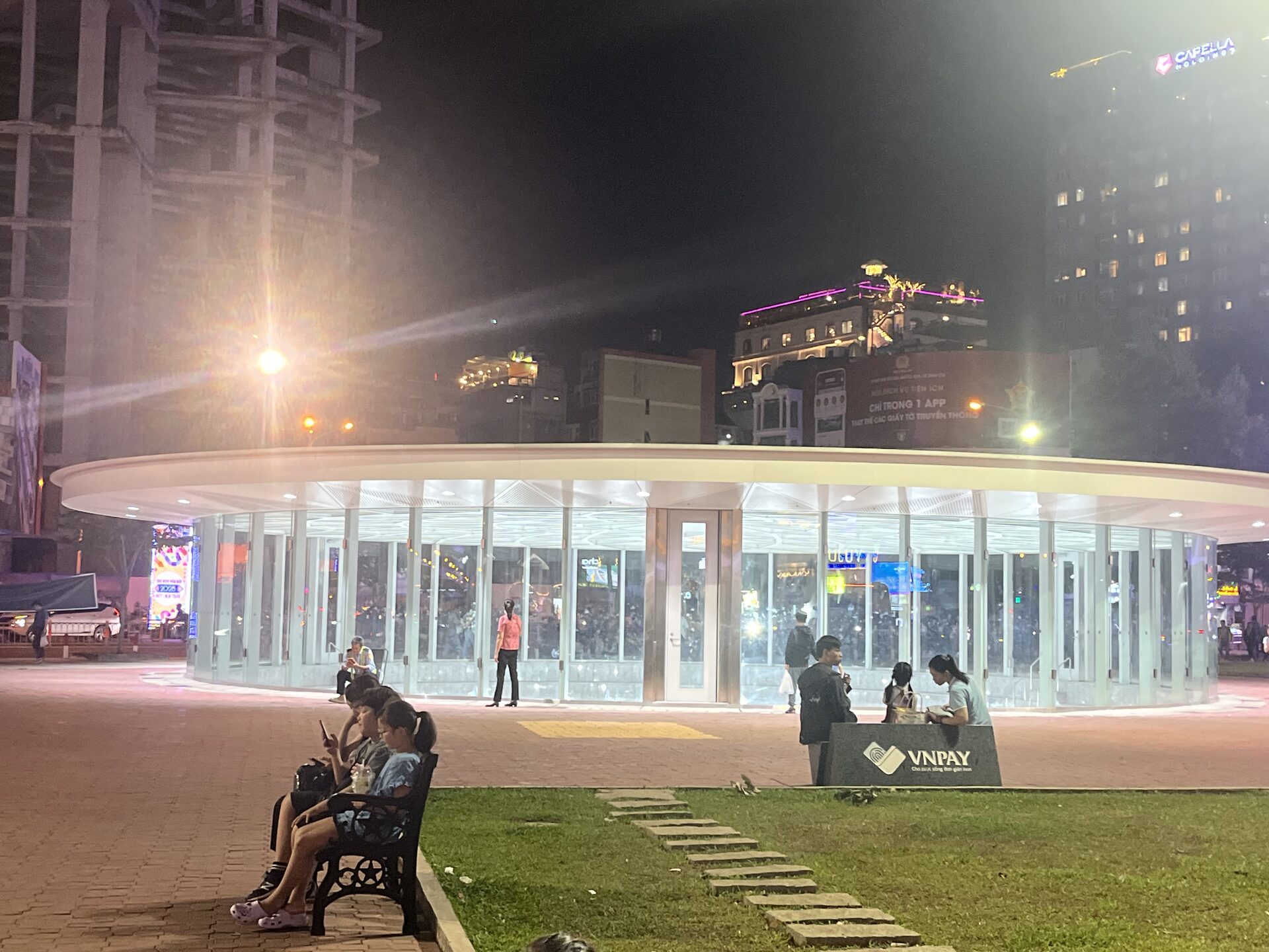
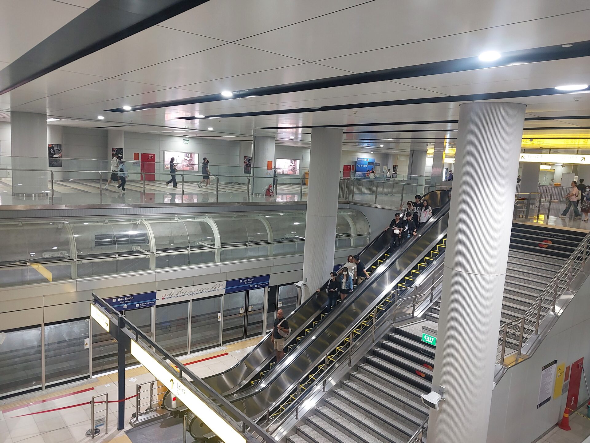
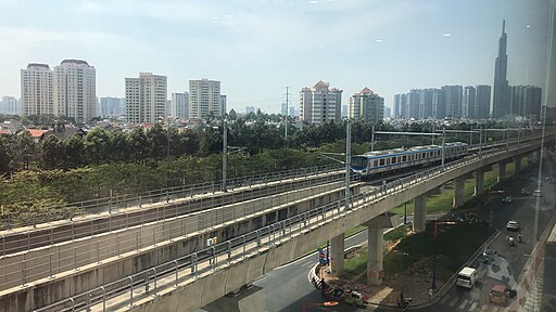
Bến Thành Station — Author: Xuanphuocle — License: CC0 1.0 — Source (Commons): https://commons.wikimedia.org/wiki/File:Ben_Thanh_Station_241224_1.jpg — Locally hostedBến Thành interior — Author: Felix Běhavý — CC BY 4.0 — Source: https://commons.wikimedia.org/wiki/File:Interior_of_the_Bến_Thành_Station,_HCMC_metro,_line_1.jpg — Locally hostedThảo Điền Station — Author: Xuanphuocle — CC0 1.0 — Source: https://commons.wikimedia.org/wiki/File:Ga_Th%E1%BA%A3o_%C4%90i%E1%BB%81n_041224.jpg — Locally hostedLine 1 on a viaduct — Author: HikariTenshi — CC BY 4.0 — Source: https://commons.wikimedia.org/wiki/File:HCMC_Metro_No1_Ben_Thanh_Suoi_Tien_in_Thao_Dien,_Thu_Duc.jpg — Locally hosted
General information
System: HCMC Metro (Ho Chi Minh City Metro). Lines in service: 1 (Line 1 Bến Thành–Suối Tiên). Stations: 14 (3 underground and 11 elevated). Length: 19.7 km (2.6 km underground; 17.1 km elevated). Track gauge: 1,435 mm. Electrification: 1.5 kV DC via catenary.
Operator: HURC1. Owner: MAUR. Signaling: CBTC. Platform screen doors: yes (all). Rolling stock: 17 Hitachi 3-car trains (≈930 passengers per train; aluminum carbody; blue exterior livery).
Opening date: Dec 22, 2024. The first month of service was free (through Jan 20, 2025), and headways, signage, and platform doors were fine-tuned after isolated rain and lightning incidents.
How to read the map: find Bến Thành (historic center) and your destination; if you’re moving around District 1, the underground stops Opera House and Ba Son cover almost the entire tourist and shopping spine. Heading east, the elevated ones (Tân Cảng, Thảo Điền, National University) connect modern neighborhoods, riverfronts, and Suối Tiên park.
Lines
Line
Terminals
Length
Stations
Und.
Elev.
Doors
Opened
1
Bến Thành ↔ Suối Tiên
19.7 km
14
3
11
Yes
Dec 22, 2024
Speed and travel times: technical max 110 km/h on viaduct and 80 km/h in tunnels; approach to station 35 km/h and 25 km/h on platform. End-to-end trip ~30 min. Between adjacent stops, allow 1–2 min.
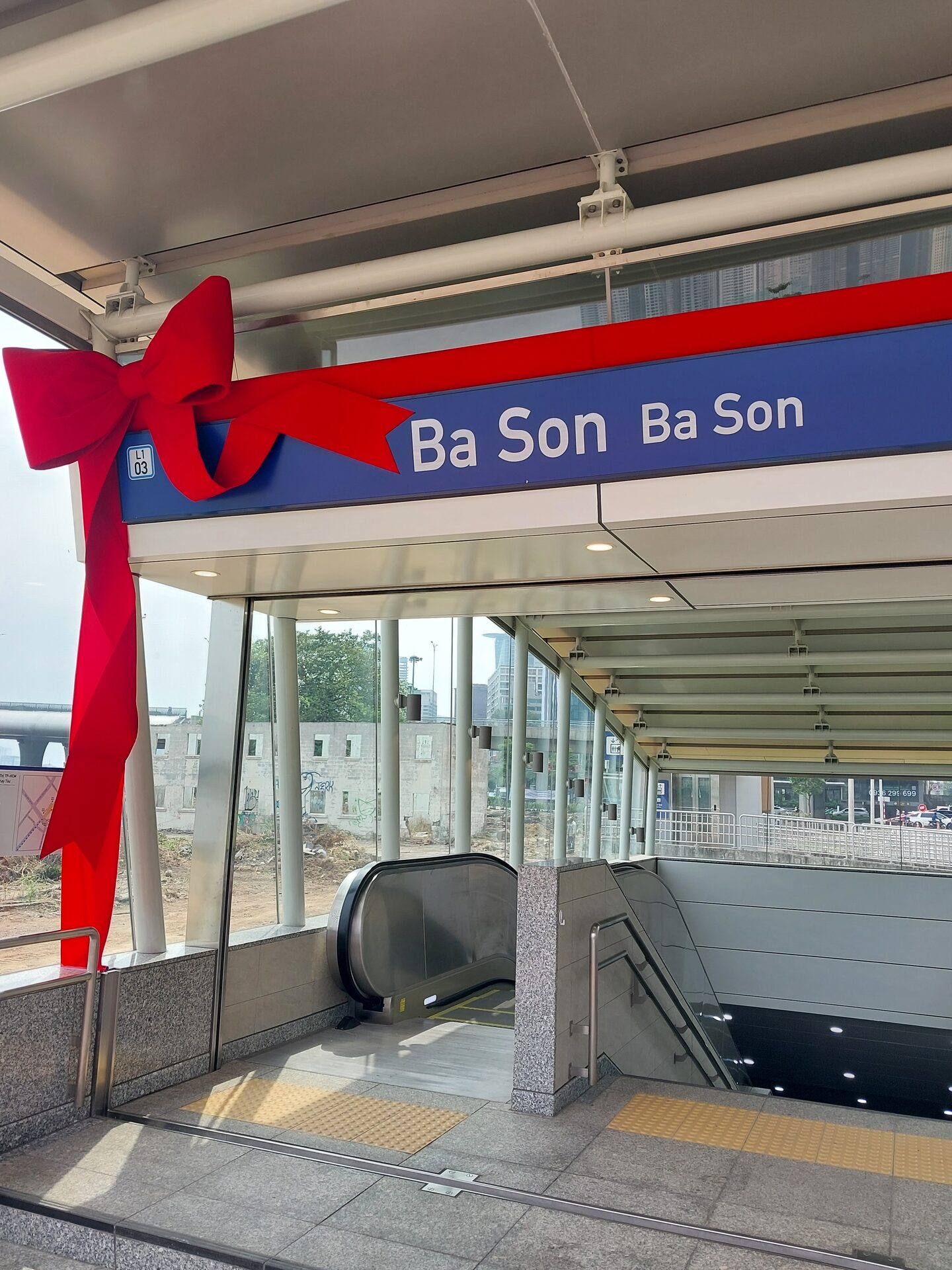
Ba Son station entrance — Author: Xuanphuocle — CC0 1.0 — Source: https://commons.wikimedia.org/wiki/File:Entrace_to_Ba_Son_metro_station,_HCMC_metro.jpg — Locally hosted
Connections to other systems
For now only Line 1 is running, so transfers are with city buses (including electric feeders between District 1 and Thủ Đức), public bikes (dozens of docks in the center and along elevated corridors), and taxis/ride-hailing at major stations.
Bến Thành: downtown hub; will concentrate future transfers between lines.
National University / Hi-Tech Park: links to the eastern education and employment clusters.
Tickets and fares
Single ticket (cash): 7,000–20,000 VND (distance-based). Cashless: 6,000–19,000 VND (bank contactless or app; small discount vs cash).
Product
Validity
Price
When it makes sense
1‑day pass
24 h
40,000 VND
Plan with 4–6 rides in one day (center + Thủ Đức).
3‑day pass
72 h
90,000 VND
Long weekend visits or an intense 72 h.
Monthly standard
30 days
300,000 VND
Long stays or daily use.
Monthly student
30 days
150,000 VND
Frequent campus commutes.
Exemptions
—
0 VND
Seniors and people with disabilities.
Payment methods: ticket office and machines (cash), contactless bank card, NFC smart card (reloadable red or single-trip blue), and app with QR code compatible with local e‑wallets.
Tip: with 3 or more segments in a day, the 1‑day pass is usually cheaper and you can forget about per‑kilometer tiers.
Hours and frequency
Phase 1 (initial): 05:00–22:00. Headways: 8 min peak / 12 min off‑peak. Typical peaks: 06:00–08:00, 11:00–12:00, 15:30–18:00.
Phase 2 (after the first months): 05:00–23:30. Weekdays: 5–7 min (peak), 10 min (regular), 15 min (low). Weekends and holidays: 8 / 10 / 15 min.
End‑to‑end time: ≈30 min between Bến Thành and Suối Tiên.
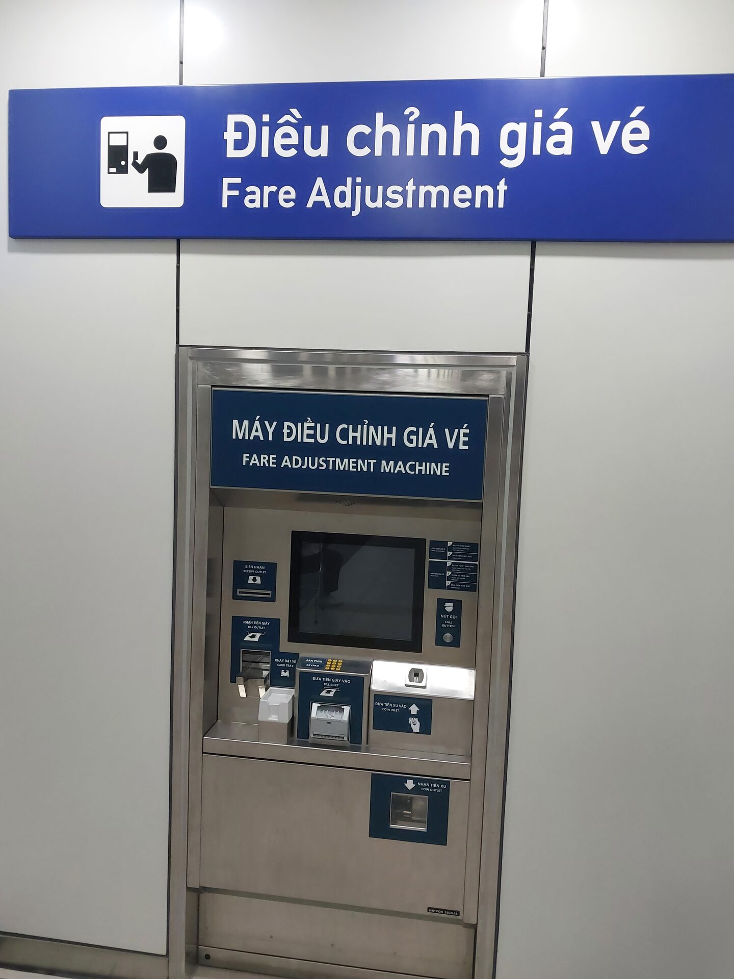
Fare machine (Ba Son) — Author: Felix Běhavý — CC BY 4.0 — Source: https://commons.wikimedia.org/wiki/File:Fare_adjustment_machine_in_Ba_Son_metro_station,_HCMC_metro.jpg — Locally hosted
Rules
Prohibited: flammable or hazardous materials, weapons, or self‑defense tools.
No smoking or eating/drinking on board; strong‑smelling foods must be sealed.
No skates or skateboards; avoid loud music or phone calls.
Respect the yellow line; don’t lean on doors or try to open them; do not throw objects onto the track.
Do not board or alight during door closing or after the audible signal.
Harassment, disturbances, unauthorized peddling, and offensive language are prohibited; performances or promotional filming require a permit.
Accessibility: stations with elevators, braille signage, PA announcements, and platforms with PSDs; on board there are reserved spaces for wheelchairs.
Airport connection
Line 1 doesn’t yet link to Tân Sơn Nhất. To get to/from the airport, combine the metro with a bus or taxi/ride‑hailing from downtown (Bến Thành). The master plan includes Line 4 with a direct airport connection.
Future extensions
Line 1 (extension): toward the An Hạ Depot (total planned length 40.8 km).
Line 2 (Bến Thành–Tham Lương): tunneling and stations scheduled to start; it will be the second major urban axis.
Network plan: up to 10 lines (~510 km), plus complementary alignments (LRT/Tram) and private investment proposals.
Bến Thành — market, shopping streets, and local food (on foot).
Opera House — theater and Đồng Khởi axis (shops and cafés).
Ba Son — stroll along Bach Dang by the Saigon River.
Tân Cảng — Landmark 81 ~1 km away (observation deck and mall).
Thảo Điền — cafés, boutiques, galleries, and a laid‑back nightlife.
National University — Suối Tiên theme park (end of day).
Approximate times: Bến Thành to Opera House ~3–4 min; to Ba Son ~6–7 min; to Tân Cảng ~12–14 min; to Suối Tiên ~30 min total. Between adjacent stops, 1–2 min.
Pro tips
Avoid rush hours (morning and late afternoon) or plan your indoor visits then; save longer trips for late morning or late evening.
Elevated accesses: expect footbridges and elevators at viaduct stations; bilingual signage helps with wayfinding.
If you’re carrying luggage: use elevators and avoid the ends of the platform; PSDs reduce drafts and crowding.
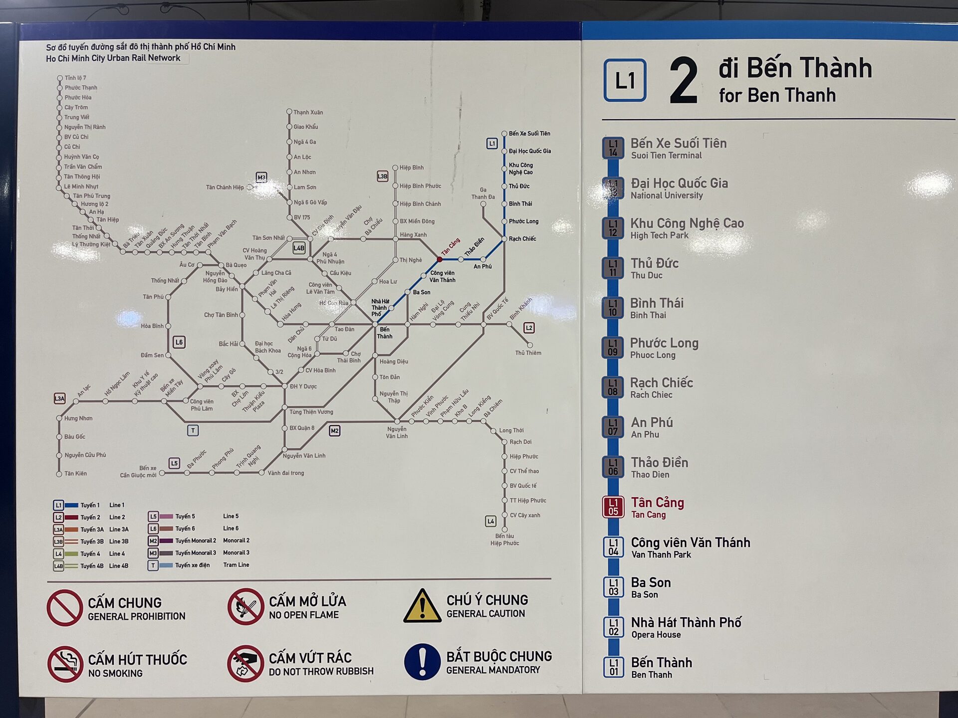
Ho Chi Minh City metro map
Overview of the current network (Line 1) and planned alignments. We’ll publish our own vector map when available; meanwhile, you can use the official station diagram.
General map — Credits: official information from MAUR/HURC1 — Locally hosted.
FAQ
What time does it open and close?
Phase 1: 05:00–22:00. After the first months, 05:00–23:30. On holidays there may be occasional adjustments.
Which pass is best value for 48–72 hours?
For sightseeing with lots of stops, 1 day (40,000 VND). For 48–72 h, consider the 3‑day pass (90,000 VND).
Is the airport included?
No. There’s no direct link to Tân Sơn Nhất yet; it’s planned with future Line 4. In the meantime, combine metro with bus/taxi.
Can I pay with a contactless card?
Yes: contactless bank cards, NFC smart card, and an app with QR; plus cash at machines and ticket offices.
How long is the full ride?
About 30 min between Bến Thành and Suối Tiên, with 8–12 min headways in Phase 1.
Is it accessible for people with reduced mobility?
Yes. There are elevators, signage, and PA; platforms with PSDs and onboard spaces for wheelchairs.
Brief history
2001: initial metro network proposal as part of the comprehensive transport plan.
2007: master plan revision; at least six urban lines confirmed.
2008: Line 1 groundbreaking ceremony.
2012: main works for Line 1 start (original deadline: 2018).
2017–2023: budget and schedule adjustments; section‑by‑section testing from 2022.
Dec 22, 2024: public opening of Line 1 (first month free).
Jan 2025: isolated incidents (rain/lightning, PSD); operational adjustments.
Mar 2025: official inauguration and international recognition.
Next milestones: Line 2 (Bến Thành–Tham Lương) and airport connection via Line 4.
Ho Chi Minh Metro Map
See map full resolution. It may take a little bit to load.
If you consider that the information we provide is wrong, not accurated, outdated, translation contains errors, and you would like to help us to improve the file...you can contact us here.
Feel free to contact us if you dont find the system you're looking for and we'll add it as soon as we can!