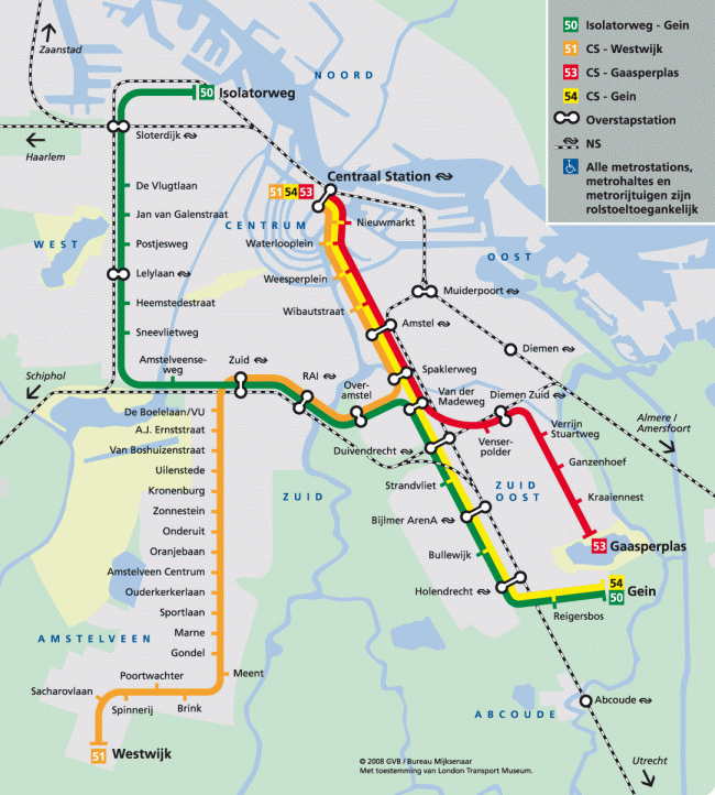
The Amsterdam Metro is the rapid transit system of the Dutch capital, operated by GVB (Gemeentelijk Vervoerbedrijf Amsterdam). The network consists of 5 lines (M50, M51, M52, M53 and M54) and approximately 39 metro stations, spanning roughly 42 km. Service runs from 05:30 to approximately 01:00, with the M52 Noord/Zuidlijn being the go-to line for tourists, connecting Noord, Centraal Station, Rokin, De Pijp and Zuid in just 16 minutes end-to-end.
The GVB 1-hour ticket costs €3.40 (2026), valid on metro, tram and bus. The easiest payment method is OVpay (contactless bank card, smartphone or smartwatch). For travellers arriving via Schiphol: the airport has no direct metro connection; the fastest option is the train from Centraal Station, Zuid, Lelylaan or Sloterdijk. Download the official GVB map with all 5 lines, stations, trams and ferries.
Amsterdam Metro: Complete Guide 2026
Basic system data
| Official name | Amsterdam Metro / Metro van Amsterdam |
|---|---|
| Operator | GVB (Gemeentelijk Vervoerbedrijf Amsterdam) |
| Owner | Municipality of Amsterdam |
| Opened | 16 October 1977 (Oostlijn) |
| Lines | 5: M50, M51, M52, M53, M54 |
| Stations (metro) | ~39 metro stations + light rail sections |
| Length | ~42 km (metro) / ~50.5 km incl. light rail M51 |
| Operating hours | 05:30–00:30 approx. (varies by line) |
| Basic fare | €3.40 GVB 1-hour ticket (2026) |
| Payment | OVpay (contactless), OV-chipkaart, GVB tickets, Amsterdam Travel Ticket |
| Airport | No direct connection to Schiphol |
| Official website | gvb.nl/en |
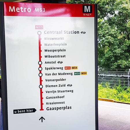 Gaasperplas station — Amsterdam Metro lines M53/M54
History of the Amsterdam Metro
Early projects (1920–1970)
The history of the Amsterdam Metro is marked by a constant tension between the need to modernise urban mobility and the fear of destroying the historic urban fabric. The first metro plans date back to the 1920s, but the city repeatedly delayed construction due to high costs and the technical difficulty of digging beneath soft, water-saturated soil with thousands of buildings founded on wooden piles. In 1968, an ambitious four-line plan was presented that would replace much of the tram network.
The Oostlijn and the Battle of Nieuwmarkt (1970–1977)
Construction began in 1970 with the Oostlijn (eastern line), which would connect the historic centre with the new south-eastern neighbourhoods, especially Bijlmermeer. The works required demolishing buildings in the Nieuwmarkt area, sparking fierce protests: the "slag om de Nieuwmarktbuurt" (Battle of the Nieuwmarkt neighbourhood) in 1975 became a symbol of urban resistance and influenced Amsterdam's infrastructure policy for decades. The Oostlijn opened on 16 October 1977.
Network expansion (1980–2000)
After opening, the network expanded with new stations and extensions. The M50 (Ringlijn) opened in 1997 as the main ring route connecting the west with the south-east of the city without passing through the historic centre. The M51 (originally the Amstelveenlijn) integrated light rail sections towards Amstelveen.
The Noord/Zuidlijn: the great modern project (2002–2018)
The construction of the M52 Noord/Zuidlijn was one of the most complex and controversial engineering projects in Dutch history. Opened on 22 July 2018, this line connects Amsterdam Noord with Amsterdam Zuid passing under the IJ river and the historic city centre. Its construction suffered serious delays, technical problems, flooding incidents and risk of settlement damage to historic buildings. Academic and technical sources cite it as an international case study in managing megaprojects in historic cities.
One of the most fascinating by-products was the Below the Surface project: during excavation at Rokin, thousands of archaeological objects were found that now form part of a public digital archive, turning the station into a genuine space of urban memory.
 Amsterdam Centraal Station — main hub for metro, tram, train and ferries
Amsterdam Metro Lines
M50 — Ringlijn (ring line)
The M50, known as the Ringlijn, is the orbital line of the Amsterdam Metro. It does not cross the historic centre but connects the west, south-west and south-east of the city. It is essential for travellers moving between Sloterdijk, Zuid, RAI, Duivendrecht, Bijlmer ArenA and Gein without going through Centraal Station. Particularly useful for workers in the Zuidas business district, RAI event visitors and peripheral rail connections. 20 stations, ~20 km.
M51 — Amstelveenlijn
The M51 has a distinctive history: for years it was a hybrid metro and light rail line reaching Amstelveen. After the reorganisation of the Amstelveen connection, it now operates as a conventional metro line within the GVB network, sharing sections with other lines. It connects Centraal Station with the Isolatorweg area in the west. Its operation includes rolling stock specific to light rail sections.
M52 — Noord/Zuidlijn ⭐ (best line for tourists)
The M52 Noord/Zuidlijn is the newest, most direct and most tourist-friendly line. It connects Amsterdam Noord with Amsterdam Zuid in a north-south journey of 8 stations and 9.7 km, passing under the IJ river. Its stops cover the most important points of interest for visitors:
| M52 Station | Visitor interest |
|---|---|
| Noord | Amsterdam Noord, NDSM, creative district in transformation |
| Noorderpark | Park and residential northern neighbourhoods |
| Centraal Station | Main hub: train, tram, ferry, bus |
| Rokin | Historic centre, Dam Square, shops, Below the Surface archaeology |
| Vijzelgracht | Canals, elegant area, near Rijksmuseum |
| De Pijp | Albert Cuyp market, gastronomy, local atmosphere |
| Europaplein | RAI Amsterdam (trade fairs and congresses) |
| Zuid | Zuidas, national and international trains, connection hub |
M53 — Gaasperplaslijn
The M53 connects Centraal Station with Gaasperplas in the south-east, following the route of the historic Oostlijn: Nieuwmarkt, Waterlooplein, Weesperplein, Wibautstraat, Amsterdam Amstel and Spaklerweg, before branching into residential south-eastern neighbourhoods (Ganzenhoef, Kraaiennest, Gooiseweg) to the Gaasperplas lake and park. ~14 stations.
Change planned for 2027: lines M50 and M53 are scheduled to merge into a single line connecting Gaasperplas directly with the Nieuw-West district, removing the direct M53 service between Van der Madeweg and Centraal Station. The aim is to increase frequencies and capacity.
M54
The M54 connects Centraal Station with Gein, sharing the central section with M53 as far as Spaklerweg and then continuing via Van der Madeweg, Diemen Zuid, Verrijn Stuartweg, Duivendrecht, Strandvliet, Bijlmer ArenA, Bullewijk, Holendrecht, Reigersbos and Gein. ~15 stations. Very useful for Johan Cruijff ArenA (Bijlmer ArenA), AFAS Live, Ziggo Dome and Amsterdam UMC (Holendrecht).
Key stations: quick guide
| Station | Lines | Why it matters |
|---|---|---|
| Centraal Station | M51, M52, M53, M54 | Main hub: metro, train, tram, ferry, bus |
| Rokin | M52 | Historic centre, Dam Square, shops, archaeology |
| Nieuwmarkt | M53, M54 | Historic neighbourhood, Chinatown, nightlife |
| Waterlooplein | M53, M54 | Market, Opera/City Hall, Rembrandt Museum |
| De Pijp | M52 | Albert Cuyp market, bars, restaurants |
| Zuid | M50, M51, M52 | National/international trains, Zuidas |
| Bijlmer ArenA | M50, M53, M54 | Johan Cruijff ArenA, concerts, events |
| Sloterdijk | M50, M51 | Train, interchange, office district |
| Amsterdam Amstel | M53, M54 | Train, tram, regional connections |
| Noord | M52 | Amsterdam Noord, NDSM, ferry to centre |
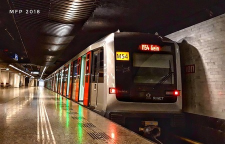
 Amsterdam Metro train in service
Rolling stock: Amsterdam Metro trains
The Amsterdam Metro fleet is undergoing renewal. Two main series currently operate:
- Alstom Metropolis M5/M6: 6-car trains manufactured by Alstom, in service since 2013–2015. These are the highest-capacity trains in the system and operate on several lines.
- CAF Inneo M7: new-generation trains manufactured by Spanish company CAF, progressively entering service since ~2022 to replace older stock and expand capacity. GVB's official M7 project information highlights improved capacity and passenger comfort.
Older rolling stock (S1/S2 series by Belgian BN, and S3/M4 series by CAF) has been retired as the M7 fleet grows.
Timetables and frequencies
Amsterdam Metro timetables vary by line. As a practical guide:
- Opening: between 05:30 and 06:00 depending on the line and day
- Closing: between 00:30 and 01:00 on most lines
- M52 Noord/Zuidlijn frequency: ~6 minutes at peak, ~7–10 min off-peak
- Other lines frequency: ~10 minutes at peak, ~15 min off-peak
- Weekends: ~15 min frequency, slightly later closing
For exact timetables and real-time departures, use the official GVB journey planner or the GVB app. Zuidasdok construction works and temporary closures may affect routes; check disruptions at gvb.nl before travelling.
Fares, tickets and payment methods (2026)
Payment methods
- OVpay: pay by contactless bank card (Visa, Mastercard, Amex), smartphone (Google Pay, Apple Pay) or smartwatch. The easiest option for tourists: simply tap in and tap out at any orange reader.
- OV-chipkaart: Dutch public transport card, anonymous or personalised. Requires a minimum balance and can be topped up at station machines.
- GVB tickets: available at station machines and in the GVB app.
Main GVB fares (2026)
| Ticket | Price | Valid on |
|---|---|---|
| 1 hour (GVB 1 hour) | €3.40 | Metro, tram, GVB bus |
| 1-day pass | Metro, tram, GVB bus | |
| 2-day pass | Metro, tram, GVB bus | |
| 3-day pass | Metro, tram, GVB bus | |
| Bicycle supplement | €2.20 | Off-peak only |
Indicative 2026 prices. Check updated fares at gvb.nl/en/prices.
Tourist tickets
- Amsterdam Travel Ticket: combines GVB (metro/tram/bus), NS train and Schiphol connection. Available for 1, 2 or 3 days. Ideal if arriving by plane and wanting full mobility without buying a separate train ticket.
- I Amsterdam City Card: includes unlimited GVB transport plus museum entry and discounts. Valid for 24h, 48h, 72h or 96h. Useful for tourists combining museums and transport.
Common tourist mistake
⚠️ Always tap in AND tap out. If you forget to tap out when leaving, you will be charged the maximum fare. Validators are at both entrances and exits of each station.
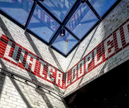
 Interior of an Amsterdam Metro station
Connection to Schiphol Airport
The Amsterdam Metro has no direct connection to Amsterdam Airport Schiphol (Luchthaven Schiphol). Schiphol is Europe's third busiest airport and the main KLM hub, located about 15 km south-west of the city. Options to reach the airport:
- NS train (recommended): direct service from Amsterdam Centraal, Zuid, Lelylaan and Sloterdijk. Journey ~15–20 min. Frequency every 5–10 min at peak. Buy tickets at Schiphol or NS machines, or use OVpay.
- Bus 397 / N97: night bus and train alternative, towards the city centre. Slower but useful at certain times.
- Amsterdam Travel Ticket: includes the Schiphol–Amsterdam train journey + GVB urban transport, ideal for visitors.
- Future M52 extension to Schiphol: extending the Noord/Zuidlijn towards Schiphol and Hoofddorp is under study, but in 2026 the funding gap is estimated at between €3 billion and €6 billion. No confirmed start date.
Architecture and art in the metro
Rokin and the Below the Surface project
Rokin station on the M52 is probably the most fascinating from an archaeological perspective. During excavation of the Noord/Zuidlijn, thousands of objects were found in the bed of the former Rokin river: coins, tools, toys, weapons and everyday objects from past centuries. The Below the Surface project (belowthesurface.amsterdam) documents and displays them online.
M52 design
The Noord/Zuidlijn (M52) stations were designed by architecture firm Benthem Crouwel, with a distinct visual identity per station: specific materials, integrated public art and unique lighting solutions. Rokin's floor uses Mosa Quartz ceramic tiles, and each station incorporates permanent artworks from the Noord/Zuidlijn Kunstroute programme.
Weesperplein: the ghost level
Weesperplein station (M53/M54) holds a little-known architectural curiosity: part of its infrastructure was built in the 1970s as a shelter or additional level that was never fully put into use. It is cited as one of the metro's oddities that generates debate among transport enthusiasts.
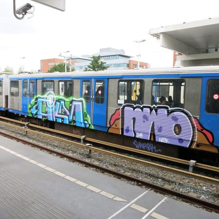
 Amsterdam Metro carriages
Accessibility
GVB provides official information on accessible travel and step-free access. In general, the metro is one of Amsterdam's most accessible modes of transport, especially at the modern M52 stations, which have lifts, wide doors and step-free routes. Older stations may have limitations. Recommendations:
- Use the official journey planner with the step-free route option
- Check lift status before travelling (gvb.nl step-free access)
- Wheelchairs and mobility scooters are permitted; check available spaces in advance
Connections to other transport systems
The Amsterdam Metro is not the only mode of transport in the city: GVB integrates metro, tram, bus and ferries under the same ticketing system.
- GVB trams: 14 lines, ~80 km. Trams cover the historic centre that the metro does not serve directly. Centraal Station connects with lines 1, 2, 4, 5, 9, 13, 16, 24 and 26.
- GVB buses: 40+ routes complementing metro and tram.
- GVB ferries: free of charge, crossing the IJ between Centraal Station and Amsterdam Noord. Very useful and an integral part of experiencing the city.
- NS trains: from Centraal Station, Zuid, Sloterdijk, Lelylaan, Amsterdam Amstel and Duivendrecht to the wider region and the country.
- Bicycle: Amsterdam has ~60% of internal journeys by bike. Most metro stations have bicycle parking.
System rules
- Smoking is prohibited throughout all facilities
- Eating and drinking is permitted, avoiding mess and strong odours; hot drinks in sealed containers
- Valid ticket required; tap in and tap out on every journey
- One passenger per turnstile (except children under 4)
- Appropriate noise level; do not play music through speakers
- Bicycles permitted off-peak (restriction approx. 7:00–9:00 and 16:00–18:30) with supplement
- Do not put feet on seats
- No alcohol or substance consumption on the metro
- Wheelchairs and pushchairs have priority in designated spaces
- CCTV cameras throughout the system
Future expansions
M50 + M53 merger (planned late 2027)
The most significant network reorganisation in years: lines M50 and M53 are planned to merge into a single line directly connecting Gaasperplas with Nieuw-West, while the M53 section between Van der Madeweg and Centraal Station will lose its direct link to Gaasperplas. The aim is to improve system-wide frequencies and capacity. The change divides user opinion: some gain direct connections, others lose their direct link to Centraal Station.
M52 extension to Schiphol and Hoofddorp
The major strategic project is to extend the Noord/Zuidlijn (M52) from Amsterdam Zuid towards Schiphol and Hoofddorp, creating a direct metro link between Amsterdam city centre and the airport. The Vervoerregio Amsterdam and the Dutch government have backed this option, but in January 2026 it was reported that the budget faces a shortfall of between €3 billion and €6 billion. No confirmed construction start date.
CBTC technical modernisation
The City of Amsterdam is working on technical signalling modernisation (CBTC, Communication-Based Train Control) to increase frequencies and capacity without expanding infrastructure.
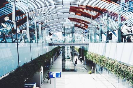 Amsterdam Centraal Station from the platforms
Practical tips for visiting Amsterdam by metro
- Use OVpay: the simplest way to pay. Tap in and tap out with your credit card or smartphone. No queues, no physical ticket needed.
- M52 is your line: for sightseeing, the Noord/Zuidlijn connects Centraal, Rokin (centre), De Pijp (market and bars) and Zuid (trains). It is the most frequent and modern.
- Don't forget to tap out: in Amsterdam you must always validate entry AND exit. Forgetting to tap out results in the maximum charge.
- Don't confuse metro and tram: trams cover the historic centre (Leidseplein, Museumplein, Anne Frank House). For those areas, the tram is a better option than the metro.
- Schiphol by train: always use the train from Centraal Station or Zuid for the airport; it is faster than any bus.
- GVB app: download it for real-time timetables, route planning and ticket purchase. Available on iOS and Android.
- Peak hours: avoid the metro between 7:30–9:00 and 16:30–18:30 if travelling with large luggage or a bicycle.
- Bicycles on the metro: permitted with a supplement (€2.20) but not during peak hours. Check the restriction timetable before entering.
Interesting facts about the Amsterdam Metro
- All lines start with 5 (M50, M51, M52, M53, M54). This numbering follows GVB's broader bus and tram numbering system.
- Construction of the Oostlijn (1970–1977) sparked the Nieuwmarkt protests, one of the most famous episodes of urban resistance in the Netherlands.
- The M52 Noord/Zuidlijn took 16 years to build (2002–2018) and cost several billion euros, far over the original budget.
- There is a planned station that never opened: Sixhaven, intended as an intermediate stop on the northern M52 between Noorderpark and the IJ.
- During M52 excavation at Rokin, archaeological objects from the 14th to 20th centuries were found; the Below the Surface project documents them online.
- GVB also operates trams, buses and ferries under the same integrated ticket.
- Bicycles are permitted on the metro (off-peak), which is unusual for major European systems.
- Amsterdam Noord, accessible for decades only by ferry, is now just 3 stops from Centraal Station by metro.
Frequently asked questions — Amsterdam Metro
- How many lines does the Amsterdam Metro have?
- 5 operational lines: M50 (Ringlijn), M51 (Amstelveenlijn), M52 (Noord/Zuidlijn), M53 (Gaasperplaslijn) and M54. A network reorganisation with an M50–M53 merger is planned for late 2027.
- How much does a ticket cost on the Amsterdam Metro?
- The GVB 1-hour ticket costs €3.40 (2026), valid on metro, tram and bus. The easiest option for tourists is OVpay (contactless bank card). Confirm the current price at gvb.nl/en/prices.
- Does the Amsterdam Metro go to Schiphol Airport?
- No. The metro does not serve Schiphol directly. The best option is the train from Centraal Station or Station Zuid (~15 min, very frequent). Bus 397 is also available. The M52 extension to Schiphol is under study but has no confirmed date.
- What time does the metro open and close?
- Approximately 05:30 to 00:30–01:00 depending on the line and day. The M52 is the most frequent line. For exact times use the planner at gvb.nl or the GVB app.
- Which line is best for tourists?
- The M52 Noord/Zuidlijn: connects Noord, Centraal Station, Rokin (historic centre), De Pijp (market) and Zuid (international trains). It is the most frequent, modern and direct.
- How do you pay on the Amsterdam Metro?
- With OVpay (any contactless bank card or smartphone), OV-chipkaart (Dutch card), GVB tickets at machines or in the app, or tourist passes such as Amsterdam Travel Ticket or I Amsterdam City Card.
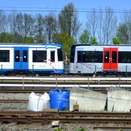
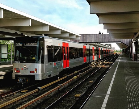 Van der Madeweg station — lines M53 and M54
What to see near metro stations
Centraal Station (M51, M52, M53, M54): arrival point for most tourists. Within walking distance: Nieuwendijk, the Jordaan neighbourhood, Nieuwe Kerk (New Church), the Royal Palace on Dam Square and the famous canals. Direct connection to all city centre trams.
Rokin (M52): station in the historic heart. Five minutes on foot: Dam Square and Royal Palace, Kalverstraat (main shopping street), Begijnhof (historic courtyard), Amsterdam Museum, cheese shops and the Singel canal.
Waterlooplein (M53, M54): famous flea market, Muziektheater (Opera), City Hall, Rembrandt House Museum and the former Jewish Quarter. Close to the Hortus Botanicus (botanical garden founded in 1638).
Nieuwmarkt (M53, M54): historic neighbourhood with the Waag (medieval weigh house), organic markets, bars, restaurants and the entrance to Chinatown. Very lively, especially at weekends.
De Pijp (M52): Amsterdam's most bohemian and multicultural neighbourhood. Albert Cuyp market (the largest open-air market in the Netherlands, open Monday–Saturday), dozens of ethnic restaurants, speciality coffee shops and nightlife.
Vijzelgracht (M52): close to Museumplein (Rijksmuseum, Van Gogh Museum, Stedelijk), Heineken Experience and the most photographed canals in the city. Also near Leidseplein.
Bijlmer ArenA (M50, M53, M54): for major events: Johan Cruijff ArenA (Ajax, international concerts), AFAS Live, Ziggo Dome. Area with shopping centre and entertainment.
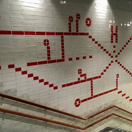 Exterior view of an Amsterdam Metro station
Update history
- May 2026 — Full rewrite: 5 lines updated, CAF M7 rolling stock, OVpay, 2027 network reorganisation, 2026 fares, 11 languages
- July 2019 — Fares and M52 line update
- October 2017 — General content revision